I visit Oakham about twice a year, and on my last couple of visits have done a bit of ad hoc mapping. The town, like the rest of the county of Rutland, was largely mapped many many years ago over one weekend by the Rutland Mapping party. It has received only a little attention since.
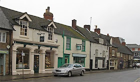
When I visit the Rutland Bird Fair I usually travel by bus, so the first thing I ever noticed about Oakham on OSM was that it was missing the road off the main street to the bus terminus. I was eventually able to fix this during the 2009 Bird Fair. I made a few other corrections, but also added an 'e' to Catmos Street, which provoked comment on talk-gb. (In my defence, OSM had Uppingham Road as Catmos Street for 3 years). Last year I added the Tescos car park and a couple of shopping arcades.
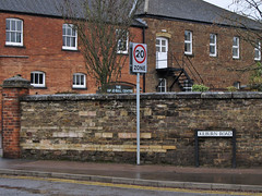
 On Wednesday, I thought I'd sneak off and clean-up some mis-matches between OSM data and OS Locator. More or less as soon as we arrived I noted an unrecorded footpath, and then a small residential road opposite the library. This is the problem with Oakham, superficially it looks to be mapped in detail. In practice, there are still plenty of significant features missing. For instance, there are loads of 20 mph speed limits around schools (e.g., on Kilburn Road, Ashwell Road and Braunston Road).
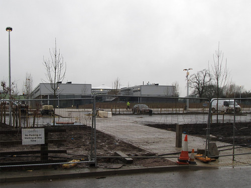
Furthermore, most mapping is now four and a half years old, and Oakham is changing. The most obvious change is a huge construction site on the Barleythorpe Road: the Catmose Campus which will house a sports centre, and new buildings for the main secondary school in the area. I walked past it in the rain (photo below): apparently the school may move in next Monday (a bit optimistic I'd have said). However, if the last couple of years are anything to go by, this dramatic addition won't get mapped in detail for a while.
Other changes are impending: Sainsbury's just had a planning application for a supermarket turned down, and Waitrose have one pending. In the summer there was a for sale sign over the Agricultural Showground suggesting that it has been zoned for housing. Even the shops on Mill Street which I've mapped show many changes from the same street a year or two ago as can be seen by looking at Google StreetView.
There are other issues with the mapping: both tagging and mapping practice have changed since 2006. Most GPS data is probably more accurate, and of course we have aerial photos, and OS data as well.
BUT, most of all, what we lack,is someone based locally. Someone aware of what is happening in the community, such as this interestingly acrimonious planning meeting. Someone able to pop down to the library or the study centre in the Rutland County Museum to check old maps or other sources for names; Someone who knows whether the sixth-form college is called "The Rutland College" or "Rutland County College", and , indeed, what's going to happen to it if Waitrose build a supermarket on its current site; Someone who can act as an advocate for OSM with groups like the formidably active local history society. Surely if someone is willing to compile a list of bells, clocks, scratch dials for Rutland, there might be one person interested in something as mainstream as contributing to a map. This is not just true for Oakham and Rutland, but for many places in Great Britain.
Not for the first time I wondered if a mapping party, consisting mainly of visitors, might have the same effect as an import. The town looks nicely mapped on the slippy map, so no-one notices that there's lots to check and correct: indeed if I regularly drove to Oakham I might not have noticed these deficiencies in the first place. I collected data in the rain with these doubts in mind. I'll map what I can, there is far more which needs to be checked, corrected, and enhanced than anyone can collect in a fleeting visit.

No comments:
Post a Comment
Sorry, as Google seem unable to filter obvious spam I now have to moderate comments. Please be patient.