Another data set released by my local council contains the locations of all the
street lights owned (or operated) by the council. Now I have no intention (or any desire) to import this data into OpenStreetMap. Is it any use in the open data context?
There are two obvious questions that can be asked using street light data:
- How well mapped are all public highways (i.e., including footways and cycleways) in the city?
- Are the highways on OSM accurately mapped?
Street lights are spaced at specific intervals according to the type of highway, it's width and the nature of the light source. This means that their accurate placement is determined by the council beforehand, all location data is to the nearest metre. Since most lights are situated immediately adjacent to the road carriageway they will be a short distance from the road centre line (say under 10 metres).
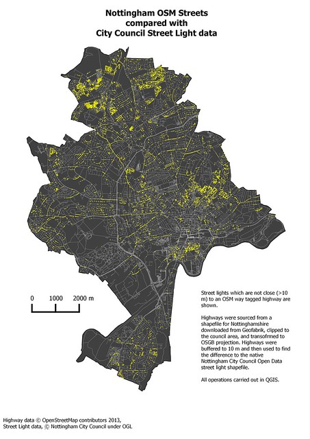
It is trivial to buffer the network of highways from OSM (via a Geofabrik download) and then use geometry operators to find all lights within the highway buffer envelope, and all outside the envelope. Using a very simple constant buffer of 10 metres I obtained the following result:
 |
| Street lights which are not close to OSM roads (best viewed large). |
|
|


