This is a very belated write-up of the May Nottingham pub meet-up.
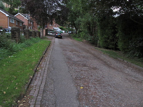
First of all it was great to meet will_p, our most productive local mapper, and to welcome Paul the Archivist who has mapped actively in his home town Derby, Birmingham and Cardiff. A few of us met at the pub for an hour walk and a bit of light mapping: this is always a good opportunity to compare notes about how different people map and talk about specific issues as they arise (such as how does one represent the surface of the road below: we didn't have a good answer!).
I find it difficult to think of an area comparable to that around the Lincolnshire Poacher which has a similar variety of different sorts of places within a couple of hundred metres: modern social housing, schools, a university campus, retail and commercial areas, pre 20th century housing, large houses, parks, gardens etc. It's also not that well-mapped, something which only really becomes apparent by walking through and checking OSM with what's on the ground. In fact our little mapping walk showed, once again, how much can be missed when one only uses aerial imagery.
We again chased down a few missing road names, but failed to see any signs on one road. Marcus pointed out a few streets along Woodthorpe Road which were blocked and not mapped properly (these are tree-lined so guessing that they connected from aerial imagery was wrong).
This time we headed into the S edge of Mapperley Park, one of the wealthier parts of the city, and a great contrast from St Anns, just the other side of the ridge line. We only followed three or four roads but it was very clear that the original sources of OSM data were pretty poor: this was a mix of NPE maps and aerial imagery. Density of mature trees in Mapperley Park made it difficult to identify the actual road lines from aerial imagery. We walked down Redcliffe Road the upper parts deeply cut into the rock and supported by Bulwell Stone walls . These stone walls area a classic sign locally of a private development between about 1880 and 1960. After 1960 the quarries were running short of this attractive Magnesian Limestone. Many are now used for housing or industry close to Bulwell town centre.
 The most interesting site along this road were a couple of cast-iron boundary markers from 1859: these list the mayor and town clerk of the Town of Nottingham (it didn't become a city until some time later). In style they are very similar to the markers used when the City boundaries were extended in the 1930s (see an earlier post). I was intrigued because I didn't know which area was on the other side of the boundary. Fortunately we have an old map at home (Salmon's map) which is virtually contemporaneous with these boundary markers. I took a couple of pictures of the same area that we walked through showing the state of Nottingham in the early 1860s. This clearly shows the boundary, and that Mapperley Park and much of the Forest were in the parish of Basford. Basford was incorporated into Nottingham in the 1880s.
Also of interest is that the road was then called Red Hill Lane. Some road names in St Anns have been preserved although in altered form after re-development, but quite a few on the roads around Bellevue Reservoir seem to have been lost. It's not clear what name the paths round the reservoir have themselves: this old map calls it St. Anns Hill, which now belongs to a road which was then called Blenheim Villas, whereas modern maps (and some from the 1930s) name it as part of Corporation Oaks.

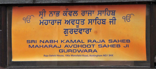
Returning to the pub along Mansfield Road we had a better look at the prominent church shown at the top of the blog. Paul had noted that it seemed to be a Gurdwara, a Sikh Temple, and as we passed it took a 'photo of the notice board. The following day I felt compelled to do a bit of research: How long had it been a Gurdwara? Who built it? what was it's recent history? I was relieved to discover that it had recently been acquired from the Christian Scientists who have moved their place of worship into their fine office building next door. But originally it was built as a Presbyterian church. So it had been a church when first mapped on OSM, but another object lesson that things ain't what they seem and the importance of ground surveys.
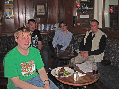
We ended up in the snug at the Poacher for a pie (Paul) and several pints.


Interesting that you go mapping together. That has happened on a couple of occasions in London, but mostly we do solitary mapping, getting together only at the pub afterwards.
ReplyDeleteThis was partly to provide a way of giving an insight to the mapping process to newcomers. However, as mapping tends to be a solitary activity, I also thought it would be nice to just occasionally do something together. We map less than we could separately, but it's nice to see how other people do things, and to come across something and say "How do you map that?". Talk in the pub tends to more wide ranging, so this is also a good chance to discuss nitty-gritty mapping stuff. It's also nice to get away from the OSMOCD mode, and collect map data in a more leisurely fashion.
ReplyDeleteIn the future I think we'll split into smaller groups (I like the idea of some of the Filipino guys to have 'slice-buddies'). I've been back over the ground of the April walk to add some more details & Paul has put a lot of detail along Mansfield Road from last month.