Thursday, 30 October 2014

War Memorials: revisiting an OpenStreetMap Project of the Week

Great Gable from Broad Crag col - geograph.org.uk - 768103
Great Gable, a mountain in the English Lake District.
The summit and around 1200 ha of the surrounding area are dedicated as a war memorial.

Four years ago I proposed mapping war memorials as the OpenStreetMap Project of the Week. It ran in early November 2010 to coincide with the anniversary of Armistice Day, when several countries honour their war dead. At the time I was intrigued at how this particular topic resonated with mappers.

I was gratified that both Peter Reed and Chris Hill felt engaged by the idea. Richard Weait, co-ordinator of Project of the Week, wrote a very interesting post about the poem "In Flanders Field" which was written by a Canadian.


Tuesday, 28 October 2014

Strava & OpenStreetMap GPS traces: a quick comparison

Strava introduced their heatmaps and their Strava Slide tool at the Washington DC conference of the OSM US community SotM-US in the spring. I had a quick look at the time and it seemed interesting, but there was little data in areas which I map.

A question came up recently regarding how accurate the Strava heatmaps are for mapping routes on OpenStreetMap, particularly in wooded areas. This prompted me to have another look at the data.

It happens that I have made a lot of traces across two paths on an open playing field (an area sufficiently unobstructed that it is used periodically for calibrating and testing professional grade GPS equipment). A short distance from these two paths is NCN 6, a heavily used national cycle route. It was therefore very easy to grab some screen grabs of Strava and OSM data:

Jubilee Campus, Nottingham : Strava Heatmap
Strava Cycling Heat Map
(NCN 6 on left, university cycle paths centre & right)

Jubilee Campus, Nottingham : OSM GPS traces
The same area showing traces which have been uploaded to OpenStreetMap
(probably mainly by me)


Thursday, 18 September 2014

OpenStreetMap at the UK Open Addresses Sympoosium

I attended the Open Addresses Symposium organised by Jeni Tennison of the Open Data Institute last month. This brought together a host of people and organisations interested in having an open alternative to the Postcode Address File (PAF).

Somewhat foolishly I'd suggested to Harry Wood that I might speak about addresses on OpenStreetMap.

Addresses mapped on OpenStreetMap in Britain
Density of address mapping in (southern) Britain on OpenStreetMap by local authority
(Northern Scotland not shown because little data, full map)
See text on map for full explanation.
I was glad to see that my talk was relatively late on in the day: the audience were unfamiliar and many of them came from large organisations., so I appreciated the chance to get an impression of them.


Tuesday, 2 September 2014

Woodland Cartography

This is an expanded version of my talk at sotm-eu:


I start by seeking inspiration from the many ways in which woods and trees have been shown on maps in the past, and then consider what elements we may want for OSM data, and how we might depict such elements.

Monday, 1 September 2014

Contributing to the Lesotho Mapathon

At the start of August I appeared in the OpenStreetMap stats for users adding most data in a day. This was the first time in ages that I've made enough edits to appear. The reason: I've been contributing this past week to a mapathon to map as much of Lesotho as possible. This has been co-ordinated by Irish OSM contributors, some of whom will travel to Lesotho early next year.

View from Lesotho village (5297237744)
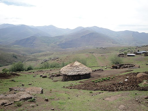
A village in Mokhotlong District.
This is S of the area I have mapped, but looks similar on aerial photos.
Source: Wikimedia Commons.
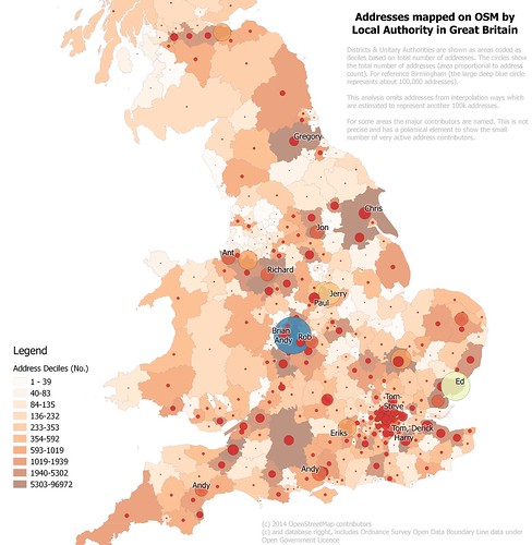
The co-ordination makes use of the HOT Task Manager: a piece of software which has distant origins in something, long gone, called QualityStreetMap.

I've use the Task Manager fairly rarely, but development over the past year has added one feature which for makes it much easier to use: the creation of a bounding box in the JOSM editor. It is now much simpler to see the area one has undertaken to map. This in turn is important in reducing editing conflicts and redundant work.


Friday, 22 August 2014

WWII Bombs in Nottingham : discovering local history whilst mapping

Last Saturday I showed 2 visitors how I mapped addresses (more on this later).


Infill housing, St Cuthbert's Road, Nottingham NG3

One little vignette stood out.


Sunday, 10 August 2014

Perhaps I was too cryptic

maprebus_2 maprebus_3 maprebus_1 maprebus_4

Each of the above maps represents objects mapped on OpenStreetMap which have a tag which corresponds to a single word. Together they spell out a topical phrase:
  • Happy. Actually name=Happy's as for some reason I had not spotted lots of name=Happy in Europe.
  • 10th. A minor fudge, using tiger:name_base=10th and restricting it to Pennsylvania to reduce the amount of data returned.
  • Birthday. A couple of retail places in Japan have name=Birthday.
  • OSM, A real fudge, I used source:name=OSM (an interesting recursive defintition in itself) 
Happy 10th Birthday OSM!