 |
| Mapping footpaths for OpenStreetMap near the Fauld Crater, East Staffordshire |
- Do some mapping together
- Walk and map unmapped footpaths
- An excuse for a post-Christmas walk
- Link up socially with Mappa Mercia
- Initiate another type of OSM activity in the (East) Midlands
I used Doodle to find a date which suited as many people as possible. This worked very well. We had a pretty much even tally of folk from the East and West Midlands. So this led me to look in the area of East Staffordshire, pretty much equally accessible for all. I also needed to find somewhere with a supply of unmapped footpaths.
In the end the choice was really easy.
The Forest of Needwood
There is an area of higher ground between the valleys of the Trent and the Dove called the Forest of Needwood. This is farming country, but is less densely populated than surrounding areas, with a more rural feel. Comparing OSM for this area with the Public Rights of Way from rowmaps showed that OSM had very few mapped as rights of way, and furthermore many were not mapped at all.Also in this area, there was an enormous explosion (possibly the largest non-nuclear explosion ever) in an armaments dump located in an old gypsum mine during WWII, which killed around 100 people and left a crater about 400 m in diameter (see bottom of post for more info). It turned out that a couple of other people interested in attending had, like me, never visited this site, So, in addition to footpaths, we could also visit somewhere for its intrinsic interest.
On the Day
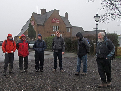 |
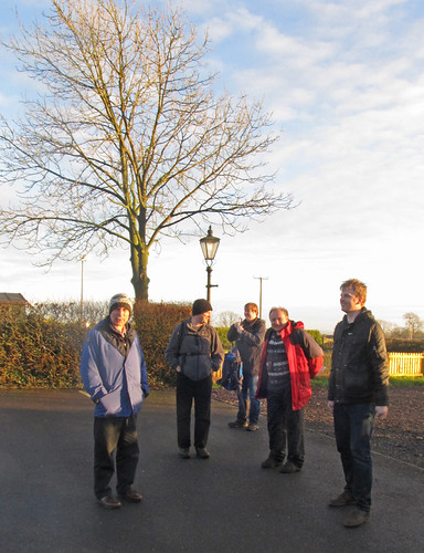
| Preparing to set off from the car park of the Cock Inn The pub was largely destroyed by the explosion and re-built after the war. |
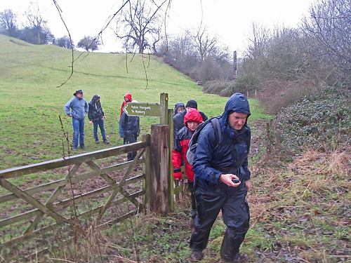
Quite early on I led us astray, although ultimately to good effect. OSM already had a path mapped to the crater which I planned to take. However not much of the local countryside had been mapped on the version on my Garmin, and the line of the path was somewhat inaccurate. (In practice several people attending the meeting had added a lot of details in the few days beforehand). I therefore followed the obvious footpath signs and only realised I'd diverged from where we were meant to go when we descended an unpleasantly steep muddy path in a wood. Perhaps if the weather had been better I'd have checked things more carefully at each path junction.
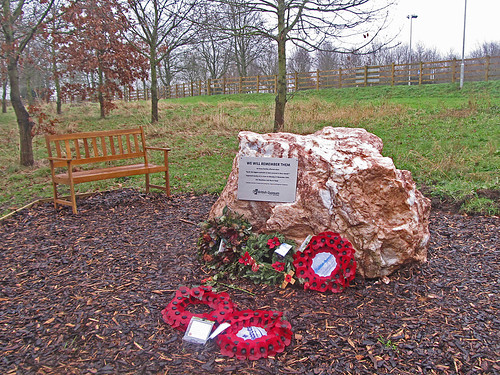 |
| Memorial to those killed at the gypsum mine, Fauld |
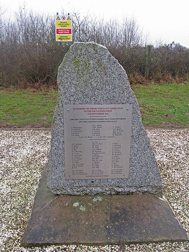 |
| The memorial at the Fauld Crater the stone is Italian granite note the names of Italian PoWs who died at the bottom of the plaque. |
 |
| The Fauld Crater, taken from near the Memorial Source: David Stowell, Geograph via Wikimedia Commons. CC-BY-SA |
 |
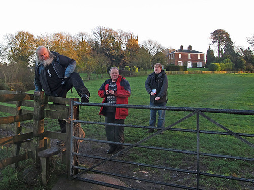
| Ready (?) for the afternoon |
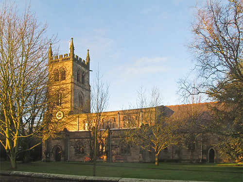 |
| St Weburgh's Church, Hanbury One of the listed buildings which were mapped. |
 |
| Much better weather in the afternoon, but the muddy ground and stiles slowed us down a bit. |
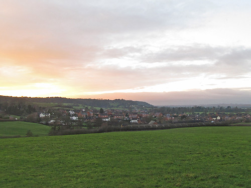 |
| Above Draycott-in-the-Clay, showing prominent scarp above valley of the Dove Fields in foreground are improved grassland (used for pasture or silage) |
See full screen
Lots and lots of other things got mapped: buildings, woods, hedgerows, historic building status, addresses. Math1985, a fellow retail mapping enthusiast, also did most of the shops in Burton before getting his train back to Birmingham.
One aspect of this is that because we spend time mapping together there was a great opportunity to discuss the hows and whys of mapping as we went along. Furthermore because many features were seen by many mappers the experience demonstrated not the differences in mapping which feature so heavily in mailing lists, but the much more extensive uncontroversial common ground. Walking together meant that we did not maximise how much we mapped, but I hope that this might be outweighed by the benefits of sharing & collaborating.
What Next?
Needless to say I was delighted at how many people turned out at shortish notice.
The format of a morning mapping activity, a sociable lunch, and the opportunity of a further mapping activity in the afternoon worked well. Brianboru came for lunch, and did some mapping in the village afterwards, others left after lunch, and some of us continued because the weather was so much better.
The plan is to repeat the format this year, most likely on a quarterly basis. We'll try and vary the mapping theme, but also try to choose a place like Fauld which has intrinsic interest. A likely venue for the near future is the National Memorial Arboretum, where I can perhaps indulge my interest in mapping trees!
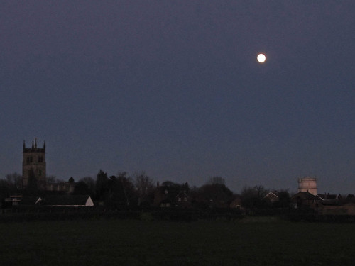 |
| Return to Hanbury at dusk. |
All in all, it was great to start the new OpenStreetMap year off with something different. Our goal for the coming year is to build on this beginning. I hope more of you might join us.
Appendix: the Fauld Explosion
 |
| Original RAF Surveillance photo of the site after the explosion This is taken from the West, edges of woods can be matched to pre-WWII maps. Source: via Wikimedia Commons, CC-BY-SA |
For those interested in learning a little more about the Fauld explosion, I've chosen some additional images and provide a guide to various links.
Normally, wikipedia would be a good starting point, and indeed most of the information there is quite reasonable. However, the size of the crater is completely wrong. It
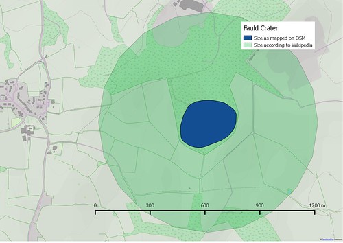 |
| Size of Fauld Crater according to Wikipedia (aka, no original research) |
- Geological Background. Tony Waltham in the Mercian Geologist. This explains the underlying geology which accounts for the presence of gypsum mines.
- Tutbury Website. A local history site for the nearby town. Excellent aerial photo of the site taken recently.
- Urban Explorers. There are a couple of fascinating accounts on UrbEx forums of visiting the site, some amazing pictures too (here, and here).
- Recent Book. A local journalist, Mark Rowe, has published a full account of the explosion in the past year.
Just a note to say malenki has been braver than me and has fixed the size of the crater in the wikipedia article.
ReplyDelete