 |
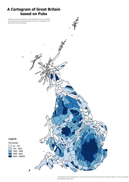
| Cartogram of Local Authority areas in Great Britain based on numbers of pubs on OpenStreetMap Created using ScapeToad, this is a simple, and naive, cartogram. |
Showing posts with label Marimekko plot. Show all posts
Showing posts with label Marimekko plot. Show all posts
Tuesday, 19 May 2015
Retail Outlets on OpenStreetMap: Cartograms, and Patchwork Quilts
I enjoyed the process of creating a cartogram from OpenStreetMap data a couple of years back, even if it was somewhat tedious. However two things stopped me from taking it further: the QGIS plugin I was using does not work with later editions, and I really wanted something a little more refined.
Subscribe to:
Posts (Atom)