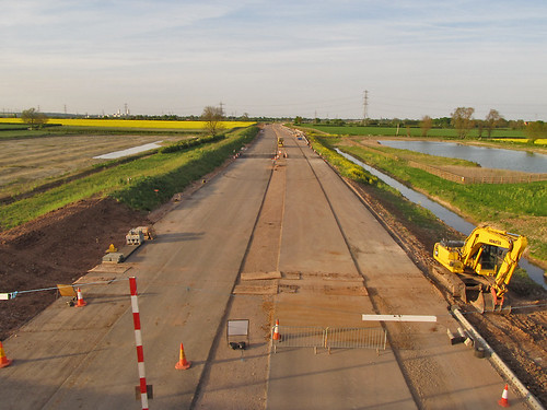
A46 road works, East Stoke : 3562a, a photo by SK53 OSM on Flickr.
The A46 between Widmerpool and Farndon (near Newark) is being reconstructed as a dual carriageway and is due to open next year.
Kev Swindells has done a great job mapping the southern section of these road works to the junction with the A6097 at East Bridgford. Several sections are already in use, and once again OpenStreetMap is more up-to-date than other online maps. The most obvious of these is the big new roundabout West of Bingham (below, also compare with Google Maps).
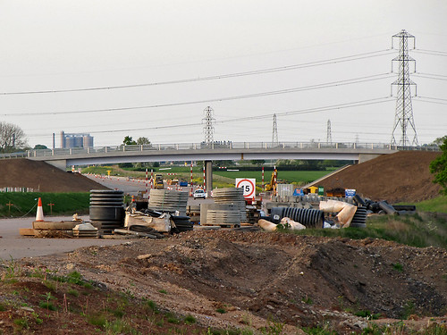
At our first pub meetup in Nottingham I asked Kev he was going to do any mapping North of East Bridgford, but apparently its beyond his normal bike runs. I'd already taken some audio notes last summer and had marked in a new overbridge near Elston. So on a nice spring evening I decided to see how much information I could collect for the remaining part of the route. I tried to cross the line of the road works on as many minor roads as I could, starting from Newark and working my way back towards East Bridgford.
Even with decent waypoints for the crossings it's not straightforward to get the rest of the alignment. Several things do help:
- Powerlines. Lots of powerlines cross the Trent S of Farndon, and all have been mapped (from surveys, Bing and OS OpenData). From photos I can check how the road alignment compares to pylon positions.
- Field Boundaries. Most field boundaries visible on Bing are still there: obviously they've gone along the construction zone, but again it's useful information.
- Hedgerow Trees. The farmland on the E side of the Fosse Way towards the River Devon has little in the way of trees and no patches of woodland. Each large tree which can be located on a photo can be matched to the Bing imagery.
- Aerial Photography. In a couple of places the Bing imagery is recent enough to be able to see that the ground has been cleared in preparation for construction. This was particularly useful just N of Flintham close to the point when the new road crosses the old road (nothing on the ground yet: presumably this will be the last phase of construction.
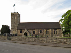

I didn't forget to collect other data: the little village of Syerston was missing all its roads. It has a nice little church too. I was able to do a bit of general tidying up of the other minor roads. Another nice church, which was already mapped is at Hawton: this has a very fine Easter Sepulchre in the chancel. Both churches are dedicated to All Saints.