Of course not all of them are useful for improving OpenStreetMap. However, many of them are.
 |
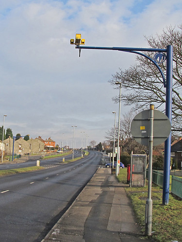
| SPECS Speed Camera, Arnold Lane, Nottingham |
I've spent a bit of time in the last month playing with these data sets, and thought it was worth sharing some thoughts about how such data could (and should) be used in the context of OSM. As there are a range of quite different data I'll discuss them in a series of posts, with conclusions at the end of the series. Somewhat quirkily I'll start with CCTV Cameras.
The location of CCTV cameras is quite interesting: it is a mix of traffic monitoring cameras and security monitoring . It is quite clear that the shapefile data is incomplete: 3 open space CCTV cameras in the immediate neighbourhood, which I have mapped on OSM are not present (here, here and here). (One of the candidates in the local council by-election makes a big thing about a couple of these). (These cameras are present on the map (link below), and are in the KML layer, but aren't in the shapefile I downloaded. Camera type 7 seems to have been missed from the latter.
Many of the traffic cameras are suitable candidates for import: in most cases these are highly visible average speed cameras (SPECS) located on the main arterial roads: they are just a pain to map as one usually remembers them when travelling at 30 mph. The remainder of the data is probably far too incomplete so that areas would still need surveying and it would be difficult to check such surveys against the data. The complete data set is shown on this map.
However, there are very interesting patterns in the data. I pulled out the cameras which are concerned with security: Open Space, Schools and Housing, mapped these and generated a simple heat map using QQIS.
 |
| Density of security CCTV owned by Nottingham City Council (NCC Open Data) |
In the main there is not much to surprise a local resident: although I'd have expected more in Clifton (the far S of the City) and the strongest density is a surprise as it is centred on high-rise flats in an area with lots of students. Three of the areas, Radford, The Meadows and St. Ann's were re-developed in the 1970s and have a huge number of alleyways which are often narrow and back on to back gardens: I'd be surprised if these did not create feelings of insecurity amongst some residents.
The main conclusion is that the map above shows places where it's not a good idea to go mapping late at night!
Bảo An cctv chuyên tư vấn lắp đặt camera quan sát tại hà nội uy tín chất lượng nhất. Cung cấp hệ thống camera giám sát qua điện thoại với công nghệ cao. Đảm bảo an ninh tuyệt đối cho không gian của bạn. Chúng tôi sẽ mang đến những loại camera quan sát siêu nét để bạn chọn sao cho phù hợp với mục đích sử dụng của mình.
ReplyDelete