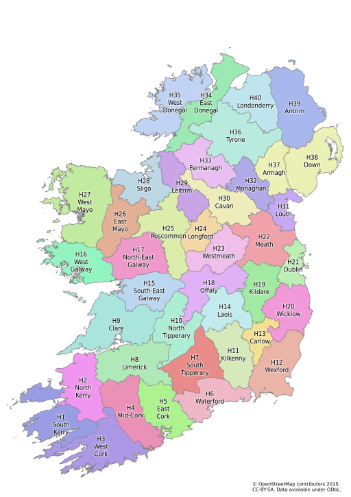
It's a wonderful example of how historical maps are of significant value in creating really useful data on OpenStreetMap which is just as relevant as it today as was in the past.
The immediate reason for writing about them is that I have been creating vice county boundaries for Ireland. In doing so I have not just been using the data, but the fantastic range of resources made available through the activities of the townlands project.
 |
| The Vice Counties of Ireland My first complete draft of the boundaries on OpenStreetMap |