Summary (tl;dr)
OpenStreetMap featured in a Public Inquiry about whether a particular route was a Public Right of Way (PRoW). I appeared as a witness at this Inquiry for Paul Sladen (another OSMer) regarding how it has been mapped on OSM. This post describes the unusual circumstances as to why the status of Lenton Road path is controversial, a bit about the history of the path, details of my statement and the hearing, and a little bit about other uses of OSM in official planning processes.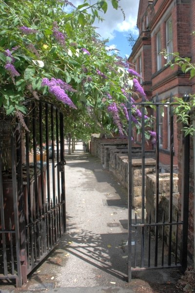 |
| Gate at the Lenton end of Lenton Road. The installation of this gate and later locking of the gate at night time was one of the sources of disagreement about the status of the footpath. Source: Mick Garratt on Geograph via Wikimedia Commons |