Despite it being just after Easter and the date being announced with only a weeks notice, there were 6 of us at the second OSM pub meet-up. This time we met at the Lincolnshire Poacher on Mansfield Road: definitely a pub worth of the
real_ale=yes tag.
With lighter evenings it seemed worth doing a bit of mapping before having a drink: also a good opportunity to show people the ropes. I chose the Poacher, not just because its a nice pub with good beer, but because there are quite a few places in the immediate vicinity which could do with more map survey work. These include the Arboretum, Church Cemetery, also known as the Rock Cemetery and residential areas either side of Mansfield Road.
I'd done a bit of preparation for each of these, but once I realised that there'd be enough of us I persuaded people to visit St Ann's. Although this inner city area has a poor reputation I knew a decent route, and it offered a much more varied insight into the issues associated with collecting data for OSM.

The main mapping objective in this area was to fix roads with missing or, possibly, incorrect names. I had made a print out (see above, and
here registration required) from
ITO OSM Analysis which provided the basis of a reasonable hours mapping. We walked
a loop down behind Huntingdon Street, along St Ann's Well Road and then along the tree-lined walks of Robin Hood Chase, Corporation Oaks, and Elm Walk back to the pub.

St. Ann's is predominantly 1970s and early 1980s social housing: the area having been re-developed as part of a slum clearance programme. It was planned with a 'Radburn' layout : lots of cul-de-sacs and interconnecting walkways. Addressing and street names are really confusing as we immediately found out. We walked through a
twitchell from Huntingdon Road and found houses with addresses on Sherwin Walk, but we were looking for Sherwin Close
. On the opposite side of the road were houses on Welbeck Walk, with Welbeck Close already mapped on OSM. This seems to be typical throughout the area: house addresses are slightly different from the streetname. In addition there are groups of houses which have a separate address, but no linked street: Rodel Court was one I noticed as we crossed Abbotsford Drive.
 Once we turned onto St Ann's Well Road everything was much greener. The road itself is tree-lined, with lots of grass between the road and housing. We popped up one road (Instow Rise) to pick off a few street-names and came across another big green open space. Back on the main road I noticed a pair of Mistle Thrushes flitting about.
 The real surprise, for those not in the know, was Robin Hood Chase: this is part of a series of green spaces preserved when the Nottingham common land was enclosed. This included the Clay Field an open field dating from mediaeval times, which covered the area which is now St Ann's. Although most of the land was very rapidly developed, a good proportion was retained. In recent years this wise decision has been marked by the Nottingham Enclosure Walk on the last Sunday in June, which takes a rambling route through the parks and gardens created as part of the Nottingham Enclosure Act. At the top end of the Chase there was an old cast iron notice stating that the council had not dedicated it as a highway. I presume this means that access rights are permissive, but more research is required. (It's worth noting, perhaps, that Robin Hood Chase does not appear on other online maps).

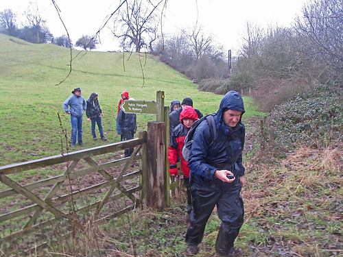
I forgot to take any photos so I've borrowed one from Geograph, and grabbed one from the 2009 Enclosure Walk. These give a reasonable idea of its role as a green lung.

We managed to add or correct around 10 street names, but we noticed a lot of other things. Here's a non exhaustive list of the various other objects which got mapped from this session: traffic tables, speed limits (20 mph zone), access restrictions, traffic calming measures (cushions, humps, bumps, chicanes), pedestrian crossings, cycle parking, an ATM, shops, restaurants & fast-food outlets, an old cinema (see picture), churches, a few house numbers, post boxes, telephone kiosks, bus stops, a green roof, and a
dead pub. This diversity is good for an introduction as most of these only require a node adding to OSM, so its possible to focus on tagging. Cycle Parking was the immediate attention grabber as there was no space at the back of the pub for a second bike: not only was the first cycle stand we came across mapped, it was used too.

There were also a few things which didn't get mapped for sundry reasons: solar-powered parking meters, hand car-wash in the former pub car-park, a SureStart children's centre, and the East Midlands Anglo Chinese Society. In the main this is because I don't know how to tag them: but hand car washes in derelict filling stations and pub car parks are becoming such a conspicuous feature of the contemporary urban landscape they probably deserve notice.
In the pub we talked quite a bit about
OpenStreetBugs: David and Marcus both seemed keen on the idea of being able to mark-up things requiring mapping as an entry-level way of contributing. Kev showed how he was using OSB to mark cycle parking. David commented that he'd want to be able to filter by a category such as 'cycle infrastructure'. We briefly talked about KeepRight as well.
This led on to David's observation that he felt that quite a lot of existing cycleways were overly generously tagged. Kev agreed and remarked that he'd recently removed a lot of cycle tags on roads in the city centre: partly in response to change signage, but also because the original mapping was less than useful for cyclists. This is definitely a theme to follow: getting some in-depth feedback on what is mapped from potential users is not particularly common with OSM. I'd like to see what we can do in this direction with the
Pedals membership.
This naturally led onto the
Nottingham Hackspace. Last month Marcus suggested the Hackspace would be a good place for an OSM event. I went along the following open evening to see the Hackspace and meet its members and have been thinking about what we can do together ever since. But early in April the Hackspace's landlord lost its tenancy, and I've been following the saga of finding a new space. This was finally resolved only on Monday: the new space is huge and located just to the east of Sneinton Market. I only hope there isn't a plan to move every month requiring a re-map of the space and its surrounding area.
Thanks to everyone for an interesting evening. Once again I find I'm learning lots by talking with people less familiar with the intricacies of OSM.
Lastly, I've set next month's date for
24th May back at the Lincolnshire Poacher.